The Sustrans Guide
The Sustrans Guide
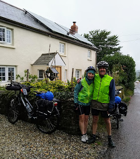
In September 2019 we road from Lands End to John O'Groats in the UK.
 |
| It rained most of the day today! |
This is the guide we used:
The guide we used for this trip is published by Sustrans - meaning sustainable transport. Sustrans is a government organization established to encourage better transport options in the UK and especially the use of bikes for commuting and recreation.They help to administer many cycle routes through out the UK. Each route has a National Cycle Route number. The Sustrans route from Lands End to John O'Groats joins up many of these routes to make a continuous route from the south to the north of the UK. Each of the routes has a number and so we would generally be following one numbered route for several days before changing to another numbered route.
It appears these routes are established and maintained by volunteers. The plus about this is that we were riding routes that only locals with lots of local experience would know about. Lots of our riding we could not have possibly figured out for ourselves. This resulted in such a fantastic quality riding experience.
The minus is that the maintainence of these routes seemed to be pretty inconsistent. Often we would be following route markers in towns or in the country - and then find we had gone the wrong way or got lost because makers were missing. This was very frustrating at times as we tried to get back on route.
It is very possible to cycle from Lands End to John O'Groats on a much shorter route than we took. You can do the whole route on tar seal. You can do it supported and a fast road bike.
But that is not the sustrans route.
This route focuses on quiet roads, canal paths, some single track, old railway lines. Probably about 30% was on gravel surfaces. Our time on busy roads was about 2% of the trip. Even in town we would often ride on the footpath rather than on a busy road. This seemed to be acceptable as long as we were courteous.
So I ended up calling our route the -
long, slow, hilly, quiet, scenic route. This route suited us perfectly - even if it took 26 days instead of 10.
The guide had an overview of the route
The route was divided into 5 main sections.
- The Southwest
- The West Midlands
- The Northwest
- Southern Scotland
- The Scottish Highlands
In the guide each section would have a general description and then an overview map of the stage.
Then within the section, each stage would have a more detailed description of the route with small maps and also pictures of and notes on points of interest along the way.
Every day I would ride with the route guide in a plastic bag turned to the pages relevant to that part of the ride. This was invaluable. But we only saw 2 other cyclists on our whole trip with this book. It is pretty new and perhaps not well known yet even in the UK.
At the end of each stage there would also be information about handy bike shops in that area and also a couple of accommodation recommendations.
At the beginning of each stage description there was also a graph showing the distances of towns along the way and also the climbs and descents in metres.
It seemed that there was no consistent scale on the maps in the guide. Which meant that some days we seemed to zoom across map pages and other days things went on for ever. And route descriptions were not always so clear.
So overall the guide was generally invaluable and wonderful but also at times frustrating. We could not have done without it.


Comments
Post a Comment